Trekking to Monte Cogne in winter
Winter hiking • Altopiano di Pine' and Valle di Cembra
Trekking to Monte Cogne in winter
Interesting excursion on one of the more panoramic peak of our territory
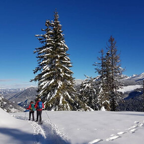
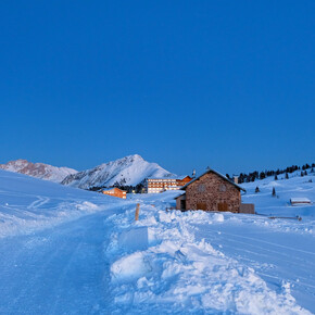
Monte Cogne is a top in a strategic position. In this excursion we propose to start from Malga Vernera, in order to reach the summit walking on the great dorsal between Altopiano di Piné and Valfloriana.
Trekking to Monte Cogne in winter

Azienda per il Turismo Altopiano di Piné e Valle di Cembra Verified partner Explorers Choice
Author’s recommendation
ATTENTION: Before starting the route, check the snow conditions with our offices. Tel. +39 0461 557028 / info@visitpinecembra.it

Safety information
Experience walking along irregular mountain trails is recommended. It may happen that the path is not clear form snow. In the event of fresh snow, microspikes are recommended. Be careful of ice when temperatures are particularly low.
Please note that the practicability of the itineraries in a mountain environment is strictly linked to the contingent conditions and is therefore influenced by natural phenomena, environmental changes and weather conditions. For this reason, the information contained in this page may have changed. Before leaving for a tour, make sure the path you will approach is still accessible by contacting the owner of the mountain hut, the alpine guides or the visitor centres of the nature parks, the info offices of the local tourist board.
Tips and hints
Piné Cembra Tourist Office - Tel. +39 0461 557028 - info@visitpinecembra.it - www.visitpinecembra.itStart
Destination
Turn-by-turn directions
Note
Public transport
From the Trento bus station, take line B403 towards Montesover (Trento - Pergine - Baselga di Pinè - Montesover) or line B402 (Trento - Nogarè - Baselga di Pinè -Montesover) and get off at Montesover. There is no public transport that connects the town of Montesover with Malga Vernera that has to be reached independently.Getting there
From the A22 Brenner motorway (from the south exit Trento sud - from the north exit Trento north) and from the Brenner state road 12, continue on the S.S. 47 of the Valsugana for Pergine Valsugana - Padua up to the junction of the Mochena for the Piné plateau, and then transiting on the S.P. 71 towards Lona-Lases and Sover, take the direction of Montesover and once in the town of Montesover, follow the signs for Malga Vernera; from here, after several hairpin bends and about 15 minutes by car, we arrive at Malga Vernera.Parking
Malga Vernera.Coordinates
Author’s map recommendations
Kompass – Valsugana, Trento, Piné, Levico, Lavarone 1:50.000 - N° 75
Kompass – Bolzano Vigneti e Dolomiti, Val di Cembra, Val di Fiemme 1:50.000 - N° 74