Malga Stramaiolo - Ex Rifugio Tonini
Mountain tour • Altopiano di Pine' and Valle di Cembra
Malga Stramaiolo - Ex Rifugio Tonini
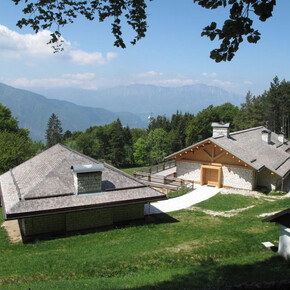
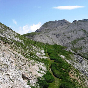
The starting point, Malga Stramaiolo, is reachable on foot or also with the car from a forest road. From there continue on foot on the path towards the Tonini hut, about 1 hour from Malga Stramaiolo.
Short and easy path that have all the difference in altitude of the climb in the first half of the path. The difference in altitude, the place and the largness of the path make it suitable for the family that want to spend some hours outside in the woods.
Malga Stramaiolo - Ex Rifugio Tonini

Azienda per il Turismo Altopiano di Piné e Valle di Cembra Verified partner Explorers Choice
Author’s recommendation

Track types
Safety information
THE 10 RULES FOR HIKERS- Prepare your itinerary beforehand
- Choose an itinerary that suits your physical abilities
- Choose suitable clothes and equipment
- Check the weather forecast
- Hiking by yourself is more risky; if this is the case, take a mobile phone with you
- Leave information about your itinerary and your expected return time
- If you are not sure about your itinerary, contact an Alpine Guide
- Pay attention to signposts and directions that you find along your way
- Do not hesitate in going back if you feel too tired
- In case of emergency call 112
Tips and hints
Piné Cembra Tourist Office - Tel. +39 0461 557028 - info@visitpinecembra.it - www.visitpinecembra.itStart
Destination
Turn-by-turn directions
Note
Public transport
From the Trento bus station, take line B403 towards Montesover (Trento - Pergine - Baselga di Pinè - Montesover) or line B402 (Trento - Nogarè - Baselga di Pinè -Montesover) and get off at Centrale di Bedollo. There is no public transport that connects the town of Bedollo with the Redebus Pass therefore the starting point must be reached by your own means.Getting there
Reach Valsugana and exit from the SS 47 della Valsugana at Civezzano and follow the signs for Altopiano di Pinè. Go through Baselga di Pinè and continue past the two lakes of Serraia and Piazze towards Bedollo. One kilometer before the town of Bedollo, turn right towards Passo del Redebus, Regnana. After Regnana, going up, about 1 km before the Redebus pass, at a hairpin bend to the right, go straight on to Malga Stramaiolo (sign). The road continues narrow but asphalted in the woods untill the "parking lot A", just few minutes from Malga Stramaiolo (1670m) where there is a ban on driving. From Valsugana it is possible to climb to the Redeus pass also passing through the Mocheni Valley. The road is longer and not very smooth.Parking
Parking place A, at Malga StramaioloCoordinates
Author’s map recommendations
Kompass – Valsugana, Trento, Piné, Levico, Lavarone 1:50.000 - N° 75