GardaTrek - Top Loop 3: a long descent to the River Sarca
Long distance hiking trail • Garda Trentino and Valle di Ledro
GardaTrek - Top Loop 3: a long descent to the River Sarca
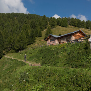
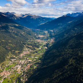
<p>From San Pietro hut (1000 m above sea level) to the valley bottom again. Another stage characterized by a great variety of lanscapes as you descend to the Sarca river shores. </p>
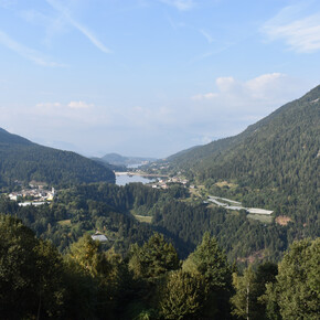
<p>After climbing Monte Biaina, between Valle Lomasona Valle del Sarca, this trail takes us back down to the valley again, a gradual descent to the River Sarca at the picturesque Roman bridge of Ceniga.</p> <p>This is a moderately difficult hike and gives you a chance to catch your breath and enjoy the landscape of Garda Trentino after the first 2 more challenging stages. While you walk in the wood you can clearly see the landscape around you change as you proceed: leaving firs and beech trees, you will meet olive trees and orchards as you approach the end of the stage. </p> <p>The only uphill stretch of this stage will take you to the top of <strong>Monte Biaina</strong>, with its peak cross: a great lookout point above northern lake Garda. The trail then leads to <strong>San Giovanni al Monte</strong>: this is where the people of Arco traditionally had their mountain cottages among the woods and meadows. </p>
GardaTrek - Top Loop 3: a long descent to the River Sarca

Garda Trentino Verified partner
From San Pietro hut (1000 m above sea level) to the valley bottom again. Another stage characterized by a great variety of lanscapes as you descend to the Sarca river shores.
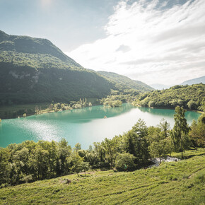
After climbing Monte Biaina, between Valle Lomasona Valle del Sarca, this trail takes us back down to the valley again, a gradual descent to the River Sarca at the picturesque Roman bridge of Ceniga.
This is a moderately difficult hike and gives you a chance to catch your breath and enjoy the landscape of Garda Trentino after the first 2 more challenging stages. While you walk in the wood you can clearly see the landscape around you change as you proceed: leaving firs and beech trees, you will meet olive trees and orchards as you approach the end of the stage.
The only uphill stretch of this stage will take you to the top of Monte Biaina, with its peak cross: a great lookout point above northern lake Garda. The trail then leads to San Giovanni al Monte: this is where the people of Arco traditionally had their mountain cottages among the woods and meadows.
Author’s recommendation
Anybody who is looking for somewhere to stop off and enjoy some local Trentino specialities is advised to take at break at Malga San Giovanni.
Garda Trentino Verified partner
Derived from the technical difficulty and the stamina requirements.
Track types
Safety information
Recommended from April to mid-October.
Safety Tips
- Choose itineraries that suit your physical and technical abilities. Collect information about the area you are visiting and the trail’s conditions and get a detailed trekking map.
- Wear clothes and take equipment that suit the difficulty and length of your tour. Keep emergency gear in your rucksack, including first aid supplies.
- Do not go walking alone in the mountains. In any case, tell someone where you are going and report back on returning.
- Look at the weather forecast before setting off and always keep an eye on the weather.
- In case of doubt, go back. It is better to give up than risk bad weather or face difficulties beyond your strength, ability and equipment.
- Do not leave marked paths and do not take shortcuts.
- All described walks are in a natural environment and therefore their use is at your own risk.
This information is subject to inevitable variations, so none of these indications are absolute. It is not entirely possible to avoid giving inexact or imprecise information, given how quickly environmental and weather conditions can change. For this reason, we decline any responsibility for changes which the user may encounter. In any case, it is advisable to check environment and weather conditions before setting out.
Tips and suggestions
You’ve picked the perfect trail – now make sure you’re ready to enjoy it to the fullest. Local hiking specialists are here to help: guides, shops and experts with the tips and support you need for every step of the way.Public transport
Public-transport-friendly
To reach San Pietro Hut there is the intercity bus line 211 (Riva del Garda - Tenno - Fiavè - Ponte Arche). Bus stop: Ville del Monte.
Attention! Buses are not very frequent!
Up-to-date information on timetables and routes.
Get Timetable to destination
Directions
Getting to the mountain hut Rifugio San Pietro:
- from Ville del Monte 556 metres a.s.l. (hamlet of Sant'Antonio) on trail 406 which passes through Canale 598 m, Case Bastiani 854 m and leads to the mountain hut – 1h 30
- from Gavazzo Nuova 201 m, on the trail Sentiero di Gola (trail 401) passing through Tenno 427 m - 2h 15
- from Malga Lomasona pasture 536 m (road from Dasindo) on trail 410 to Sella del Calino 966 m and themountain hut – 2h
Find out how to reach Garda Trentino.
Parking
Available parking close to San Pietro Hut in Loc. Calino.
Coordinates
Author’s map recommendations
Garda Trentino TREKKING Map – Available in the info points of Garda Trentino (Riva del Garda, Arco, Torbole sul Garda, Ledro, Comano Terme)
Equipment
You need to wear the right clothing and take the proper gear when you go hiking in the mountains. Even on relatively short easy outings make sure to take all you need so you don't run into trouble if things take an unexpected turn, for example a storm blows up or you have a sudden drop in energy levels.
What should you take when you go on a hike?
Your rucksack (for a day trip a 25/30L capacity should do) should contain:
- water canteen (1L)
- snacks (e.g. mixed dried fruit or chocolate)
- First aid kit
- windproof jacket
- fleece
- change of t-shirt and socks (in a plastic bag)
- make sure to wear or at least bring a pair of long trousers
- hat
- sun screen
- sunglasses
- gloves
- whistle to attract attention in an emergency
Make sure you're wearing the right footwear for the trail and season. The going can get rough and rocky underfoot and a pair of hiking boots will protect you from sprains. When wet, a grassy slope, rocky slab or steep trail can be dangerous unless you are wearing the proper footwear.
And finally... don't forget to bring your camera! You'll need it to capture the stunning views you come across all over Garda Trentino. And if you like, you can share your memories with us at #GardaTrentino.
Emergency telephone number 112.
Derived from the technical difficulty and the stamina requirements.


