Lower Giudicarie bike path

The bike path through the Lower Giudicarie is almost 20 km long. It begins in Pieve di Bono and ends in Storo.

Lower Giudicarie bike path   #1
Lower Giudicarie bike path #1

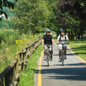
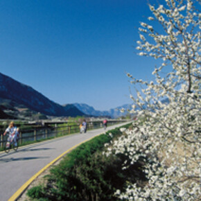
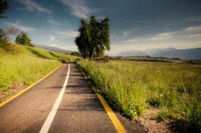
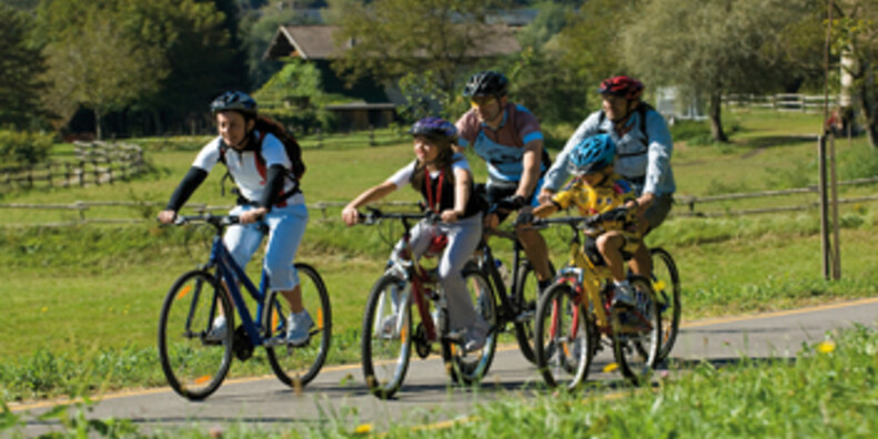
The bike path through the Lower Giudicarie is almost 20 km long. It begins in Pieve di Bono and ends in Storo. The path follows the flow of the River Chiese - an affluent of Lake Idro - and travels across a nice rural countryside, weaving both closer and further away from the river. It travels across Ponte dei Tedeschi, before crossing the River Palvico and River Lora on a traditional timber bridge, where it forks. The first branch takes bikers to Storo on a 4.2 km route along the River Palvico. The second path keeps following the left-hand side of the River Chiese and cuts across Storo plain to reach Cà Rossa - at 6.745 km from its starting-point. Cycling a bit further, the path reaches the Fontana Santa Park, at its 8.230 km. Here the road becomes unpaved as it turns into a fascinating nature trail, winding its way through a wild, solitary landscape. A number of interesting items from the past such as the "calchere" - age-old lime ovens - are scattered along the route. The path then takes bikers back across the River Chiese on a pedestrian-cycling walkway to reach the hamlet of Pieve di Bono, where it ends. In the future, the path will continue making its way further up the valley to , Roncone, Breguzzo and Tione (37.8 km) and will be connected to the Redena and Central Giudicarie paths.

 

Contact & Directions

APT Madonna di Campiglio
Fraz Cologna, 99
Pieve di Bono , Italy

Weather Valli Giudicarie and Valle del Chiese

Today
Max Temp. (C): 15°
Temp. Min. (C): 5°
Apr 28
Max Temp. (C): 19°
Temp. Min. (C): 7°
Apr 29
Max Temp. (C): 20°
Temp. Min. (C): 6°
Weather forecast


You may also like ...

12 results
Mori-Torbole bike path

Mori-Torbole bike path

he Mori-Torbole bike path is 15.5 km long and connects Valle...

The Upper Val di Non Cycle and Foot Path

The Upper Val di Non Cycle and Foot Path

From June 2012 the Val di Non welcomes cycle enthusiasts with a 25...

Valle dell'Adige Sud - Trento - Besenello bike path

Valle dell'Adige Sud - Trento - Besenello bike path

This is Trentino's longest bike path, running 80.680 km in the ...

Val Rendena Bike Path

Val Rendena Bike Path

al Redena is crossed by a striking bike path, which follows the River...

Valle del Primiero Bike Path

Valle del Primiero Bike Path

This cycling and walking path interconnects all the towns of Valle...

Val di Fiemme bike path

Val di Fiemme bike path

The Val di Fiemme bike path follows Marcialonga's route. The path is ...

Val di Sole bike paths

Val di Sole bike paths

The Val di Sole bike path runs for 34.5 km, hugging the River Noce,...

Valle del Sarca bike path

Valle del Sarca bike path

The Valle del Sarca bike path travels across 11 km of one of the most...

Mori-Torbole bike path

Mori-Torbole bike path

he Mori-Torbole bike path is 15.5 km long and connects Valle dell'Adige to Lake Garda.

Read more ...
The Upper Val di Non Cycle and Foot Path

The Upper Val di Non Cycle and Foot Path

From June 2012 the Val di Non welcomes cycle enthusiasts with a 25 kilometre route through the stunning scenery of the upper Val di Non

Read more ...
Valle dell'Adige Sud - Trento - Besenello bike path

Valle dell'Adige Sud - Trento - Besenello bike path

This is Trentino's longest bike path, running 80.680 km in the North-South direction, and is the core of the entire project of bike paths in...

Read more ...
Val Rendena Bike Path

Val Rendena Bike Path

al Redena is crossed by a striking bike path, which follows the River Sarca. The path is approximately 18 kilometres long and stretches from Villa...

Read more ...
Valle del Primiero Bike Path

Valle del Primiero Bike Path

This cycling and walking path interconnects all the towns of Valle del Primiero, starting from Imer all the way to Siror. It is almost eleven ...

Read more ...
Val di Fiemme bike path

Val di Fiemme bike path

The Val di Fiemme bike path follows Marcialonga's route. The path is open to everyone and gives cyclists the chance to travel through the entire...

Read more ...
Val di Sole bike paths

Val di Sole bike paths

The Val di Sole bike path runs for 34.5 km, hugging the River Noce, with a total drop in elevation of 664 m, from Mostizzolo to Cogolo. It can be...

Read more ...
Valle del Sarca bike path

Valle del Sarca bike path

The Valle del Sarca bike path travels across 11 km of one of the most attractive areas of countryside in the entire Trentino region.

Read more ...

Cycleways