Trekking at Cima Pontara - Lemperperg: mountain between Pinè Plateau and Mòcheni Valley
Mountain tour
Trekking at Cima Pontara - Lemperperg: mountain between Pinè Plateau and Mòcheni Valley
<p>The proposed summit is a very interesting destination for lovers of tranquillity.</p>
<p>A smaller mountain compared to the neighbouring Rujoch, but one that holds great expectations. Less frequented, very beautiful and special! <br/>A round trip to explore it on all its slopes. <br/>One last detail: an obligatory stop at malga Stramaiolo to taste some typical Trentino dishes.</p>
Trekking at Cima Pontara - Lemperperg: mountain between Pinè Plateau and Mòcheni Valley

Azienda per il Turismo Altopiano di Piné e Valle di Cembra Verified partner Explorers Choice
The proposed summit is a very interesting destination for lovers of tranquillity.
A smaller mountain compared to the neighbouring Rujoch, but one that holds great expectations. Less frequented, very beautiful and special!
A round trip to explore it on all its slopes.
One last detail: an obligatory stop at malga Stramaiolo to taste some typical Trentino dishes.

Track types
Show elevation profileSafety information
Degree of difficulty according to the common symbology: path EE (on tracks and paths)
External risks along the tour: lack of adequate signage from Polpen pass to Pontara top; however, the path track is well visible
THE 10 RULES FOR HIKERS
- Prepare your itinerary beforehand
- Choose an itinerary that suits your physical abilities
- Choose suitable clothes and equipment
- Check the weather forecast
- Hiking by yourself is more risky; if this is the case, take a mobile phone with you
- Leave information about your itinerary and your expected return time
- If you are not sure about your itinerary, contact an Alpine Guide
- Pay attention to signposts and directions that you find along your way
- Do not hesitate in going back if you feel too tired
- In case of emergency call 112
Tips and hints
Piné Cembra Tourist Office - Tel. +39 0461 557028 - info@visitpinecembra.it - www.visitpinecembra.it
Start
Destination
Turn-by-turn directions
From the Redebus pass, walk along the asphalted road for 100 metres in the direction of the Val dei Mocheni; having arrived at a large wooden sign saying 'welcome to the Val dei Mocheni', you can see two roads leading off from the main one; ignoring the one on the right which leads to the Cambroncoi hut, take the one on the left with the sign 'Fernu'. Entering the forest on the asphalt road, one immediately perceives an air of tranquillity. After about 1 km and two hairpin bends, we continue on the road signposted 'Stialt' and 'Naibis', avoiding the road that bends to the left.
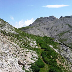
After another 600 metres, a marked uphill path can be seen on the left, which is to be taken leaving the comfortable road (signpost No. 462 and direction 'Polpen Pass'). The very steep path soon softens and after about 1 hour's walk will lead to the Polpen pass, characterised by meadows and high mountain vegetation.
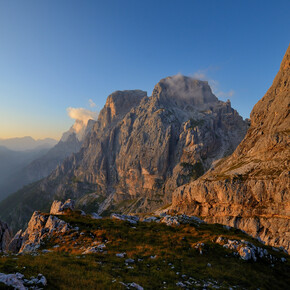
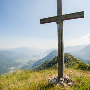
After enjoying the view of the beautiful peaks of the Val dei Mocheni, we set off for the last few metres that separate us from the summit. At the pass, we continue along the trail in a south-westerly direction, leaving the large ridge of the Rujock mountain behind us, and shortly arrive at the Pontara-Lemperperg peak.
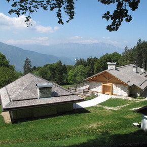
The view from up here is breathtaking and it is well worth spending some time for photographs; after refreshment with a snack and something to drink, the tour continues. We return to the Polpen pass by continuing in the direction of the "malga Stramaiolo Alta" and along a beautiful path through the rhododendrons we descend in altitude to the malga. Continuing along the road, you can see the Malga Stramaiolo hut in the distance, an excellent place to replenish your energy. Continuing along the tarmac road, after about 1 km, take the road on the left signposted "malga Pontara 443/B" to the end of the road. Continuing along the same path (443/B), we quickly reach the Regnana malga and then the Redebus pass, the starting point of this interesting circular tour.
Note
Public transport
From the Trento bus station, take line B403 towards Montesover (Trento - Pergine - Baselga di Pinè - Montesover) or line B402 (Trento - Nogarè - Baselga di Pinè -Montesover) and get off at Centrale di Bedollo. There is no public transport that connects the town of Bedollo with the Redebus Pass, therefore the starting point must be reached by one's own means.
Getting there
From the A22 Brenner motorway (from the south exit Trento sud - from the north exit Trento north) and from the Brenner state road 12, continue on the S.S. 47 of the Valsugana for Pergine Valsugana - Padua untill the junction for the Altopiano di Piné, then countinue on the S.P. 83 di Piné up to the Redebus pass.
Parking
At the 'Passo Redebus bar and restaurant' located on the pass of the same name; plenty of 'roadside' parking available.
Coordinates
Author’s map recommendations
Kompass – Valsugana, Trento, Piné, Levico, Lavarone 1:50.000 - N° 75
Equipment
Hiking shoes, rain-jacket, hiking poles, water, sun cream.