Canazei - Pian Pozata - Soracrepa - Gries
Hiking trail • Val di Fassa
Canazei - Pian Pozata - Soracrepa - Gries
<p>Walks</p>
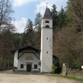
<p>On the left of the old San Floriano’s church climb "Strèda dò Ruf de Antermont" and cross the second bridge over the stream bearing the same name. Turn left almost immediately. The path becomes immediately steep, alternating difficult slopes with even sections. You will reach the very small clearing known as "Pian Pozata", characterized by a big rock and equipped with tables and benches to take a rest. After a few dozen metres, you will end up onto the "Pian Pozata" forest road. The slope continues: it is at first slight but then, as you walk along the rocky sides going on for a long section, it becomes steeper. Near the stream, the road turns into a small path again, as it was at the beginning. Cross the stream (it is quite easy to cross) and follow it down to the valley. Come out of the wood above the wide grassland area named "Soracrepa", one of the most ancient human settlements in Val di Fassa. Cross the "Ruf de Soracrepa" again and go down along the steep descent (walking poles recommended) towards the village of "Gries", formerly an independent centre in Fassa and today a part of the Municipality of Canazei. Pass by the church dedicated to the "Madonna della Neve". The eastern facade of the church is decorated with a large fresco of Saint Christopher. From here you continue on the left toward the parish church, take the stairs on the right and get back to the centre of the town by following the main road.</p>

